I've always had a great sense of direction. On foot. On foot, I can find my way almost anywhere that I've been at least once.
When I started learning to drive, however, I discovered that this is not the case when I'm in a car.
This drove my Dad to distraction-- if you'll forgive the pun-- because it really shouldn't be possible to get lost within two blocks of your own house when you have a parent with you.
So my family developed a running joke that one of these days (once I had my license) no one would see me for a few hours. Then my Dad would get a phone call from me, saying, "Dad, I think I'm lost, but I just passed a sign that says 'Welcome to Denver'."
Now, I really was intending to go to Denver a couple of weeks ago for a Music Therapy Conference. (Which was excellent, by the way, but I won't be talking much about it here) I've actually been a couple of times. That was back when I was swing dancing in college, and we'd make an annual trip to Colorado for the Intercollegiate Swing Battle. We always took the northern route, up through Wyoming, which is how I can tell you that there is absolutely nothing to look at on that drive except for signs telling you how far it is to the Little America.
 |
| It was always a tradition to stop by for those 50 cent ice cream cones and the cleanest bathrooms on the whole drive. Someday I'll have to tell you about the shenanigans from the trip when I took this photo. |
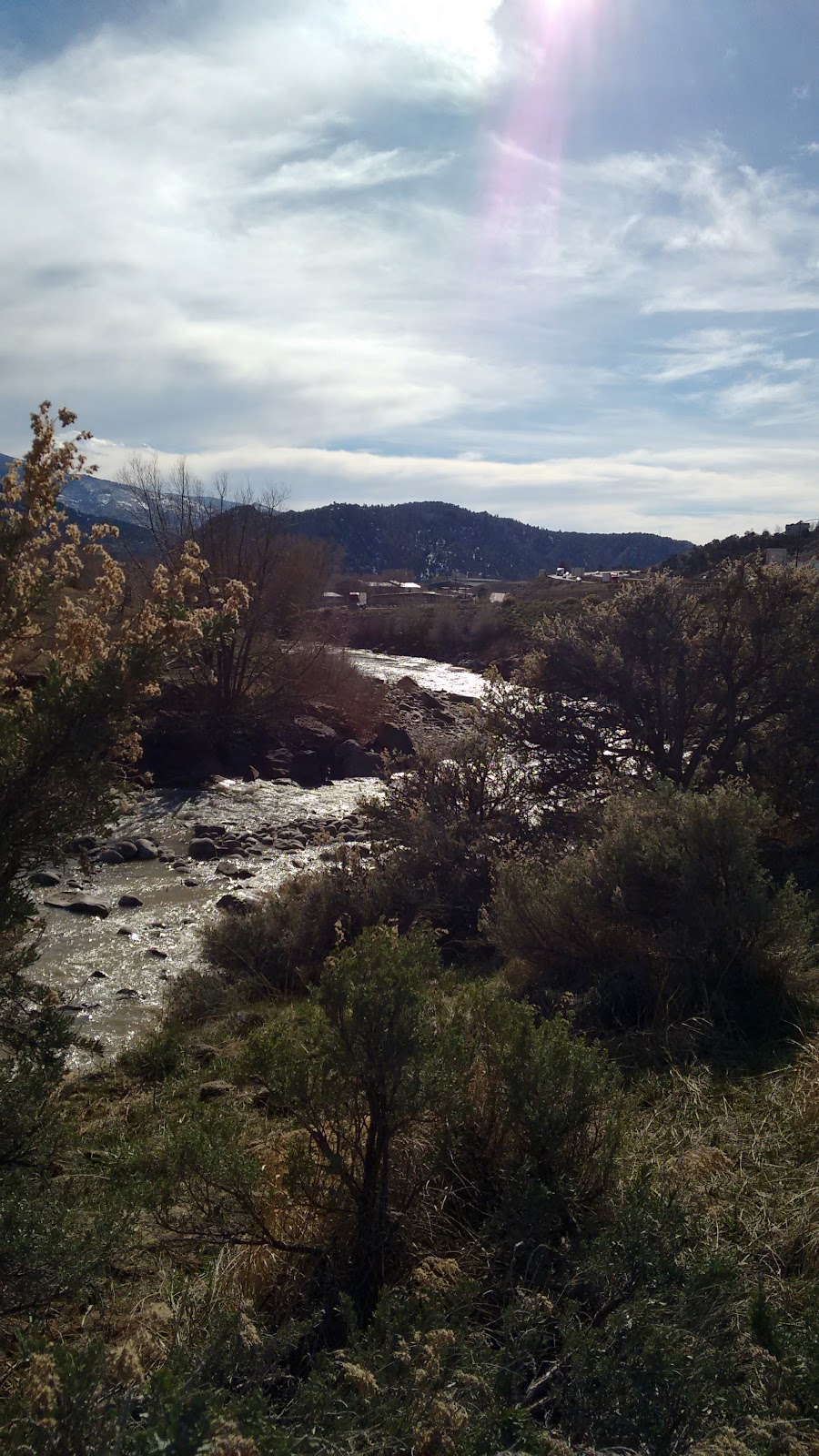
This was my first time going alone (and driving the car, for that matter), and I decided I didn't want to make that same drive again, so instead I headed a bit further south for the I-70 route. It was less than a half hour difference so I figured it would be worth it just to get a change in scenery.
Turns out that was the right decision, because I-70 passes through Glenwood Canyon. I completely failed to stop and take photos for most of it because 1) I had a long drive and 2) I was too busy enjoying seeing it myself. But if you've got seven minutes or so this video will give you an accelerated drive-through.


Some policemen were evacuating the building. Apparently they were escorting a prisoner, and the prisoner needed to use the bathroom.
I considered waiting, but I didn't really want to, so I just drove off intending to stop at the next likely rest stop.
What I found was the visitor center for a quaint little town called Eagle, Colorado.


I couldn't resist a little exploring. Most everything (other than, of course, the bathrooms) was actually closed for the winter, but they did have an old train car that was open for anyone to step inside:


And while it was closed, I did sneak a peak through the windows of what used to be a General Store.


Now, the visitor center was actually a little tricky to get to-- you could see it from the freeway but it took a few turns and smaller streets to get there. When I got back into my car I realized I wasn't quite sure how to leave. But, no worries, that's what GPS is for, right?
GPS is somewhat better than navigating while driving than I am. Somewhat. This doesn't mean that she and I don't get into some pretty ugly fights from time to time. Sometimes we both end up losing.
Anyway, GPS took in off in a direction that seemed reasonable at first. But then I found myself having to squeeze through this tiny tunnel that was only wide enough for one car at a time (and almost having a head on collision with a beat up old truck that had been racing into the tunnel from the other direction). And then the pavement ended and I was on dirt roads, driving off into some farmland. I decided this was probably the wrong way and (with some difficulty and some damage to the roadside flora) I managed to backtrack to the visitor center. Finally I did make it back to the freeway. But this whole fieldtrip left me running so late that instead of my plan to stop somewhere to freshen up and change before the opening session of the conference-- well, with my modesty preserved by a winter coat and some creativity, I changed my outfit while sitting in my car in a Walmart Parking Lot. Always classy, that's me.
So then there was the drive back.
I still don't know where I took the wrong turn. Somewhere after the first gas station on the Utah Border across from Grand Junction, CO. My GPS was actually turned off-- which sounds like a bad idea until I remind you that GPS is a huge battery drain, and when the phone tells you "Follow this road for 250 miles", it seems a little silly to put the GPS on for the whole way. I was dead certain I remembered where the turn was, too-- not to mention I was certain there would be signs. So I wasn't too worried.
Nor was I worried when I noticed that I'd driven into a large area with no cell service. It happens when you're out in the middle of nowhere. But I did start to wonder where the exit to get to Moab was, because I was certain I should have passed that by then. Still, maybe I'd just missed it. No big deal, since I wasn't actually going to Moab.
And then I saw this:

I hope you guys are ready for some more of my mediocre attempts at travel photography because I knew I had to pull over at the first view site I passed.


I've lived in Utah most of my life, but I couldn't remember ever seeing or hearing about this place. I wasn't sure how I'd missed it on the drive down.


You might notice a little path winding up that hill to the left of the above photo. I was just dying to go check it out, but this drive was on a Sunday and my current outfit was much more appropriate for church than hiking.

So I decided to do the rational, adult thing and go back to my car.
And dig through my luggage to find a pair of sneakers.
 |
| Perfect! |


I experimented (not entirely successfully) with the panorama feature on my phone camera. Which means some sideways scrolling, sorry-- I couldn't figure out a better way to show you the bigger picture.


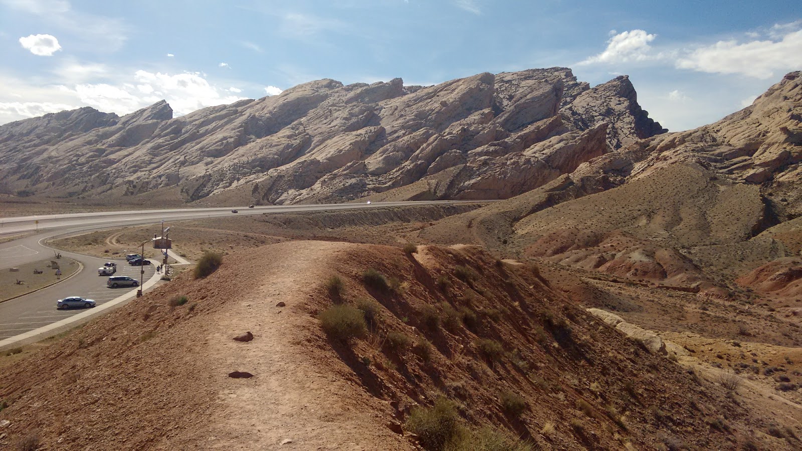

So what is this mysterious place? According to some signs, it's The San Rafael Swell.
Ignoring the fact that filming that was kind of dumb-- seriously! Locals call that first area (officially the "San Rafael Reef") "the Silent City". There is no way on earth I'm not using that in a story.
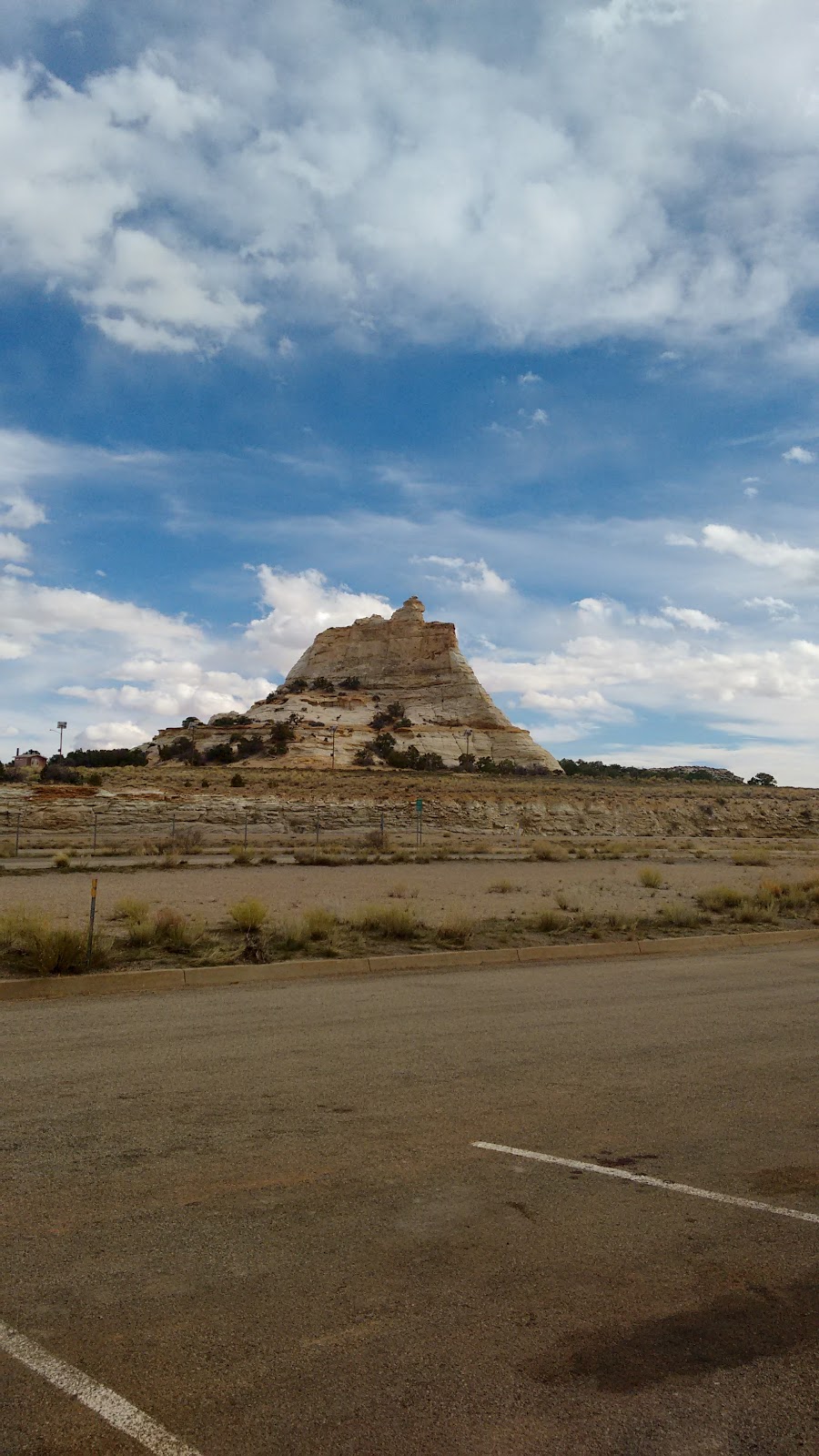
I kept stopping at various view stops-- I couldn't resist. Every mile or so had some new wonder-- like the Black Dragon Canyon, seen in these next shots:


 |
| At this parking lot was a huge display of jewelry and other souvenirs for sale-- I'm assuming the owner was in that white car because they were the only other people around when I showed up. |
There was a couple in a car on the road behind me that kept showing up at each view point parking lot just as I was leaving, which was kind of funny.
 |
| I think this rock is called "ghost rock", but I'm not positive. It could just as easily be the name of the rock in the next photo. |
 |
| In some places it was like I'd found a miniature Grand Canyon |


 |
| Another contender for the title of "ghost rock". The site was called "Ghost Rock Overlook", but I never saw a sign saying exactly which rock was Ghost Rock. |


I still couldn't get a cellphone signal, by the way-- not since the last time I'd stopped for gas. I was too busy enjoying the view to care much, though. There was still a nagging part of my brain, however, that wondered how on earth I'd missed all this on the drive down.

 |
| This particular formation is called The Sand Wash. |


 |
| I just thought this particular tree was very photogenic. |

And it was around here that I found a helpful sign.

Let's take a closer look at that.

That's as good as I can get that map, sorry, but I can summarize. I was a long way out of my route. Somewhere near the edge of Utah I had missed the turn to go North. Instead of heading up to Price, I was not that far from St George. Which meant that, no, I hadn't ever seen this place before-- it was only a bit of luck that I'd encountered it at all.
What kind of luck?
Well, it could be argued bad luck, because this little trip added what I calculated to be about 100 extra miles and about two hours to my trip. And, let me tell you, I was very much ready to be done driving when I finally did get home.
But on the other hand, if I had to get lost, it's hard to regret getting lost somewhere so full of wonders.
